|
|
|
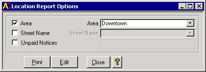
The purpose of the Location report is to provide a list of known animals, without a deceased date, grouped by area and street. Such a report is useful for an Animal Control Officer who goes door-to-door confirming that current year animal tags have been purchased. That is why it is also called the Walking Report. The first two steps to setting up this report are to create the areas then to assign street names to those areas. The Location Report Options form, showing below, is the final step.
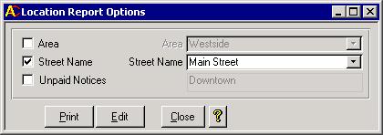
To use this form, you must decide if you want the report for a single street, or all streets within a chosen area. The example above shows the downtown area being chosen. Clicking the Print button will cause the Location Report to be printed listing all animals by street that live in the Downtown area. The example below will allow you to print the same report, except only the animals from Main Street will be included. The box underneath indicates that Main Street is within the Downtown area.
An Edit button exits as well. If the data on the report has some errors, you could click the Edit button instead. The Area Animals screen below will appear.
Using this form, you can edit all data that is showing other than the tag number. The Location Name pull down list shows valid street names from the 911 system. For an explanation of what the fields should contain, check out the Animals page.
|
|


